The Strange Tool on the Trail

July 24, 2026
Source: Reddit
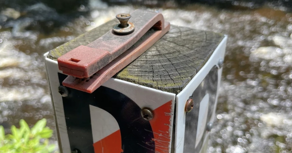
At first, I thought it was an old stapler bolted to a trail post.
Then I noticed the sharp metal pins inside. That ruled out any urge to test it with my finger.
The device is a land navigation checkpoint punch. Hikers, students, and orienteering participants use it to prove they reached a specific set of coordinates.
You place a paper control card between the jaws and press the handle. The pins punch a distinct pattern into the card. That pattern confirms you found the correct checkpoint.
Simple. No batteries. No signal. Just a paper card and a firm press.
How a Land Navigation Checkpoint Punch Works
Participants usually receive a map, coordinates, or compass bearings before starting a land navigation course.
They then travel from one checkpoint to another. Some courses require a set order. Others let participants choose their own route.
Each checkpoint has a punch attached to a post or marker. When someone reaches the location, they place the matching section of their card inside the punch and press down.
The holes serve as proof of the visit.
Course organizers compare the finished card with an answer key. If the punch patterns match the assigned checkpoints, the participant completed the route correctly.
That matters because saying, “I’m pretty sure I found it,” doesn’t count.
Why the Spikes Form Different Patterns
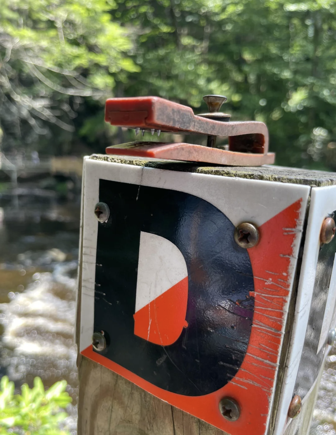
Each land navigation checkpoint punch usually has its own pin arrangement.
One may leave three holes in a triangle. Another might create a diagonal line. A third could make a shape that resembles a letter.
These unique patterns prevent shortcuts. A participant can’t find one checkpoint and use the same punch across the entire card. Repeated marks would reveal the trick immediately.
The system works like a passport, except the punch leaves holes instead of ink.
It’s low-tech, but it does the job well.
What Makes Land Navigation Challenging
Land navigation looks easy when you’re studying a map from a table.
Out on the trail, things change.
Paths curve. Streams divide. Hills block your view. A short distance on paper can feel much longer when you’re climbing over roots or checking your compass every few minutes.
I’ve looked at a map and said, “That should only take ten minutes.”
It rarely takes ten minutes.
Checkpoints may sit near obvious landmarks, such as bridges or trail intersections. Harder courses place them near ridges, stream bends, clearings, or other terrain features.
Finding the post means you read the map correctly—or at least corrected your mistakes before wandering too far.
Then comes the satisfying part: pressing the punch and adding another mark to the card.
Why Use a Manual Punch?
Electronic systems can record checkpoint visits, but manual punches remain useful.
They don’t need power, software, or a wireless connection. Rain may fade the plastic, and the screws may collect rust, but the mechanism can keep working for years.
That reliability makes them ideal for permanent courses and training areas.
A land navigation checkpoint punch also gives participants something physical to carry home. Each pattern represents a location they reached through map reading and route planning.
The card becomes a small record of the trip.
Maybe it also records a few wrong turns. Those count as part of the story.
Don’t Put Your Finger Inside It
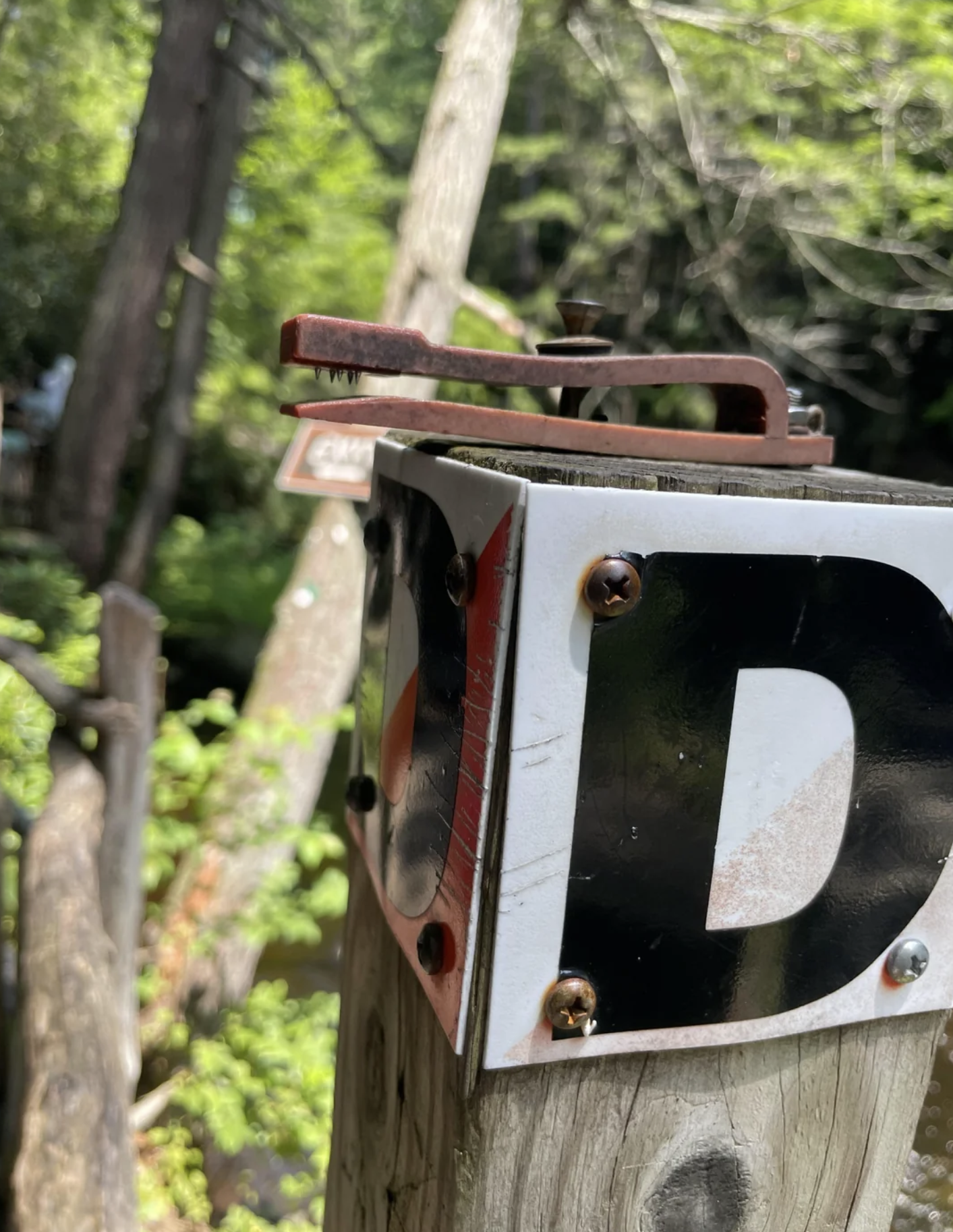
The pins are designed to pierce paper, so they can hurt.
Don’t place a finger between the jaws or press the handle just to see what happens. The result won’t be mysterious.
Also, leave the punch attached to the post. It may look old or abandoned, but it belongs to the course. Other participants still need it to complete their route.
A Small Tool With a Clear Purpose
A land navigation checkpoint punch doesn’t look impressive. Most people probably walk past one without knowing what it does.
For a navigator, though, it marks success.
It proves that the map, compass, coordinates, and careful route led to the right place. After all that work, a few holes in a card can feel surprisingly rewarding.